Zaozhuang · Mountains & Scenic Wonders
Shanting District Geological Park
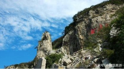
The moment you step into the Double Dragon Grand Canyon, the world suddenly goes quiet. To your sides, towering rock walls squeeze the sky into a thin sliver of light; beneath your feet, the walkway spirals down along the fissure; your fingertips brush against the cool stone. This gash, torn open by a massive earthquake over three hundred years ago, remains frozen in time within the mountain, waiting for visitors to walk in and read its story.
1. Location Overview: To be precise, the “Shanting District Geological Park” mentioned here refers to the Xionger Mountain National Geological Park. Located in Maozhai Village, Beizhuang Town, Shanting District, Zaozhuang City, it is a National 4A-level tourist attraction situated approximately 35 kilometers from downtown Zaozhuang. In 2002, the Ministry of Land and Resources approved the establishment of the “Xionger Mountain-Baoduge National Geological Park.” Both Xionger Mountain and Baoduge are part of this system, facing each other across a valley in the northern mountains of Shanting. The park is centered on Xionger Mountain, covering an area of about 18 square kilometers. Xionger Mountain reaches an elevation of 483 meters and extends about six kilometers from east to west; its main peak resembles a bear’s ear, from which it derives its name. Its most significant remnant is the “Zaozhuang Xionger Mountain Collapse and Fissure Earthquake Site,” a national-level typical earthquake site approved by the China Earthquake Administration in 2007. It also serves as a national science education base for earthquake prevention and mitigation. In Zaozhuang’s tourism landscape, it provides a mountainous and geological dimension that balances the waterfront charm of Tai’erzhuang, creating a harmony of “one mountain, one water” between the north and south of the city.
2. Cultural and Geological Context: The Xionger Mountain area features the “Gao” landform typical of Central-South Shandong. The mountain body consists of Cambrian strata, with a top layer of hard, thick limestone and a lower layer of softer shale and sandstone. After long-term weathering and erosion, this resulted in the characteristic “Gao” landscape: flat tops and steep cliffs. However, the true catalyst that reshaped the mountain’s fate was an earthquake. On July 25, 1668 (the 7th year of Emperor Kangxi’s reign), a massive 8.5-magnitude earthquake struck the Tancheng area with a maximum intensity of XII, one of the rarest and most catastrophic earthquakes in the history of Eastern China. The violent shaking caused Xionger Mountain to collapse and split, sending boulders tumbling and tearing a grand canyon right through the heart of the mountain. According to the *Kangxi Tancheng County Gazette*, during the quake, “the ground split, springs surged, and water erupted two to three zhang high,” affecting over 150 prefectures and counties around Tancheng. This area sits on the Tan-Lu Fault Zone—the largest giant fault zone in Eastern China and still a vital specimen for understanding seismic activity in Eastern North China. In November 2007, the national-level typical earthquake site and education base were officially unveiled here. Xionger Mountain lays the results of crustal movements bare on the surface, serving as a natural classroom for seismology and geology, while the surrounding mountain villages preserve the rustic folk customs of Southern Shandong.
3. Highlights: The must-see attraction is the Double Dragon Grand Canyon. Located between Xionger Mountain and Mudan’an, it runs generally east-west, stretching about 500 meters in length, with widths ranging from 0.5 to 15 meters and depths between 30 and 80 meters. It is divided into four sections: the first features massive stalactites hanging from the cliffs; the second, “Dragon Claw Cliff,” is a single-walled precipice over 100 meters long with more than twenty boulders weighing hundreds of tons scattered below; the third consists of intersecting main and branch valleys that resemble two entwined dragons; and the fourth is half open-air canyon and half underground limestone cave, featuring “Sliver of Sky” views and “Flying Stones.” Beyond the canyon, there are other limestone caves like Huanglong Cave, underground labyrinths, and tiered Gao cliffs, where stalactites and stalagmites create myriad shapes under the lights. From the summit, you can overlook the clusters of Gao cliffs and the pastoral landscapes below, enjoying fresh air and high forest coverage. The park’s earthquake science exhibition hall uses models and artifacts to explain faults, collapses, and prevention knowledge, turning the crack beneath your feet into a complete lesson in Earth Science. For researchers, this is some of the most direct physical evidence of the Tancheng earthquake; for ordinary tourists, it transforms textbook geological terms into a tangible, walkable reality.
4. Visitor Information: Opening Hours: Open during the day, typically starting at 8:30 AM. Entry usually stops around 4:00 PM, with the park closing around 4:30 PM. Hours may be slightly earlier in winter; please refer to the daily announcements at the site. We recommend allocating 3 to 4 hours for the visit. Tickets: Adult tickets are 60 RMB; discounts are often available on online platforms. Students, seniors over 60, children, active military personnel, and people with disabilities may receive half-price or free entry based on national and park policies upon presentation of valid ID. Address: Maozhai Village, Beizhuang Town, Shanting District, Zaozhuang City. Transportation: Self-driving is the most convenient. Navigate to “Xionger Mountain National Geological Park.” It is about 35 kilometers from downtown Zaozhuang (approximately a one-hour drive), and parking is available. For public transport, take a bus from Zaozhuang toward Shanting to Beizhuang Town, then transfer to a local vehicle. Note: The canyon has many steps and some sections are narrow and damp; please wear non-slip sports shoes and exercise extra caution during the rainy season. Seniors and young children should proceed according to their physical capacity. Most paths are mountain trails, and summer afternoons often bring thunderstorms; we suggest entering the park in the morning to allow plenty of time to descend. Visitors with average fitness may choose to return after reaching the highlight sections of the canyon rather than pushing for the summit.
5. Travel Tips: The recommended route is “Science First, Scenery Second”: start at the earthquake science exhibition hall to understand the Gao landform, the Tan-Lu Fault Zone, and the events of the 1668 earthquake. Then, follow the trail up Xionger Mountain and hike through the Double Dragon Grand Canyon. After exiting the canyon, explore the limestone caves or view the boulders at Dragon Claw Cliff depending on your energy, and finally ascend to the peak for a panoramic view of the cliffs and countryside. For photography, use a wide-angle lens in the canyon to capture the “Sliver of Sky” and the texture of the cliffs; as the lighting is dim, you may need to increase the ISO. For the summit view, morning light is ideal. This is a perfect natural classroom for families with children, as kids are typically fascinated by earthquake knowledge and caves. Hikers and photographers should reserve half a day. Mobile signal is weak in some parts of the canyon; please inform your companions of your itinerary before entering. Dining options inside the park are limited; we recommend bringing your own water and snacks. Use sunscreen in summer and windproof warm clothing in winter. If you plan to visit Baoduge on the same day, the two mountains complement each other—one focused on science and the other on forest scenery—but be aware that this is physically demanding, so an early start is advised.
6. Best Time to Visit: Xionger Mountain has four distinct seasons. Spring and autumn are the best times for hiking—spring brings blooming mountain flowers, and autumn offers vibrant foliage and clear visibility. Summer is a great time to escape the heat in the dense shade of the forests and the cool depths of the canyon, though be extra mindful of the weather as the canyon can be slippery during the rainy season. Winter presents a stark, cold beauty with snow-capped rocks. Around the National Disaster Prevention and Reduction Day in May, the park usually hosts concentrated science activities, making it an ideal time for educational family trips. The park is located in Shanting along with Baoduge National Forest Park, Yiyun Stone Tribe, and Yanma Lake, making it easy to form a one or two-day geological tour. For a taste of the local area, try Shanting-style pancakes, multigrain pancakes, and Zaozhuang spicy chicken. After descending the mountain, enjoy a farmhouse feast in Beizhuang Town, where wild mountain vegetables and free-range chicken are in season. Chestnuts, hawthorns, and walnuts from the mountain are also worth bringing home. A 500-meter canyon has frozen the earth-shaking events of three hundred years ago into a walkable exhibit—this is the irreplaceable value of Xionger Mountain.